Humminbird Great Lakes, Plus
|
|
상품가격 상세보기
이벤트보기
|
- 상품상세정보
상품특징
Make sure this fits by entering your model number.Aerial only this layer shows only Aerial imagery and no other map informationAerial + LakeMaster contours this layer shows the colored LakeMaster map and the Aerial imagery that extends around the body of waterAerial + contours only this layer shows the Aerial imagery and just the LakeMaster contours so you can still pick out those features in the water while still seeing your depth
상품설명
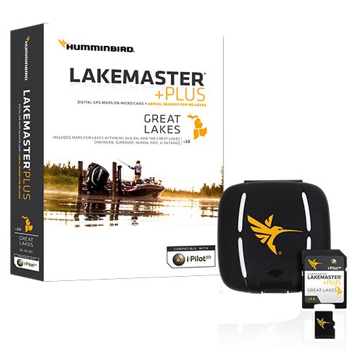
The Humminbird LakeMaster plus great lakes edition, Micro map card has added over 140 lakes, 50 high definition waters to now boast contours for a total of over 1540 lakes with more than 380 lake maps in high definition for Michigan, Indiana, and Ohio. Plus has all of the features you've come to love from LakeMaster, but allows for aerial image overlay on high definition waters. Now you have the ability to use quality aerial photography to view the entry and exits of creek channels, see how far a Reef or weed line extends, pick out shallow water rock piles, steep drop-offs and other features of the lake you've been missing from traditional maps. Lakemaster plus gives you the freedom to choose how you want to use the aerial imagery. Features:- aerial only this layer shows only aerial imagery and no other map information.- aerial + LakeMaster contours this layer shows the colored LakeMaster map and the aerial imagery that extends around the body of water.- aerial + contours only this layer shows the aerial imagery and just the LakeMaster contours so you can still pick out those features in the water while still seeing your depth. - each map card edition covers some of the most popular water bodies in the region and the plus Series also gives you access to all of the LakeMaster features including the following:- easy to read contours- depth highlight range- water level offset- shallow water highlight- scrollable lake list. Includes:- Micro card with SD adapter- waterproof carrying case
Make sure this fits by entering your model number.Aerial only this layer shows only Aerial imagery and no other map informationAerial + LakeMaster contours this layer shows the colored LakeMaster map and the Aerial imagery that extends around the body of waterAerial + contours only this layer shows the Aerial imagery and just the LakeMaster contours so you can still pick out those features in the water while still seeing your depth
상품설명
The Humminbird LakeMaster plus great lakes edition, Micro map card has added over 140 lakes, 50 high definition waters to now boast contours for a total of over 1540 lakes with more than 380 lake maps in high definition for Michigan, Indiana, and Ohio. Plus has all of the features you've come to love from LakeMaster, but allows for aerial image overlay on high definition waters. Now you have the ability to use quality aerial photography to view the entry and exits of creek channels, see how far a Reef or weed line extends, pick out shallow water rock piles, steep drop-offs and other features of the lake you've been missing from traditional maps. Lakemaster plus gives you the freedom to choose how you want to use the aerial imagery. Features:- aerial only this layer shows only aerial imagery and no other map information.- aerial + LakeMaster contours this layer shows the colored LakeMaster map and the aerial imagery that extends around the body of water.- aerial + contours only this layer shows the aerial imagery and just the LakeMaster contours so you can still pick out those features in the water while still seeing your depth. - each map card edition covers some of the most popular water bodies in the region and the plus Series also gives you access to all of the LakeMaster features including the following:- easy to read contours- depth highlight range- water level offset- shallow water highlight- scrollable lake list. Includes:- Micro card with SD adapter- waterproof carrying case
2019-04-07 06:53:40