Garmin 010-01199-20 GPSMAP 64st Worldwide Handheld GPS 1 Yr. Subscription Preloaded US Map + 32GB Memory Card + LED Brite-Nite Dome Lantern Flashlight + Carrying Case + 4X AA Batteries w/Charger
|
|
상품가격 상세보기
이벤트보기
|
- 상품상세정보
상품특징
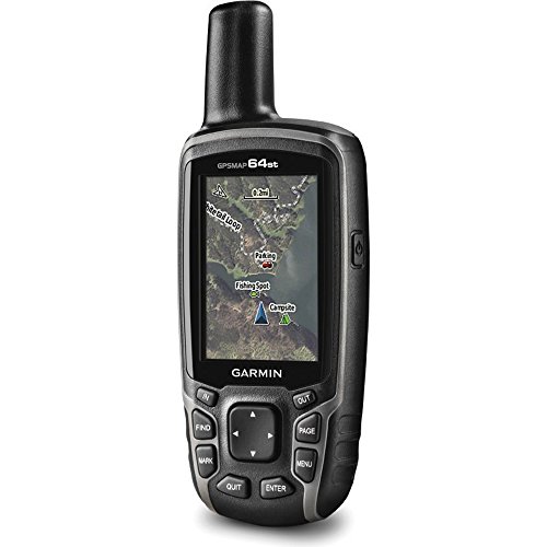
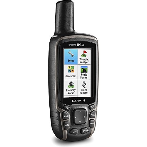
Garmin AUTHORIZED DEALER - Includes Full Garmin USA WARRANTYGarmin GPSMAP 64st Worldwide Handheld GPS 1 Year BirdsEye Subscription Preloaded US Map2.6" sunlight-readable color screen & a high-sensitivity GPS & GLONASS receiver with a quad helix antennaINCLUDED IN THE BOX: Garmin GPSMAP 64st Worldwide Handheld GPS - Preloaded TOPO U.S. 100K maps - 1-year BirdsEye Satellite Imagery subscription - Carabiner clip - USB cable - ManualBUNDLE INCLUDES: Garmin GPSMAP 64st Worldwide Handheld GPS 1 Yr. BirdsEye Subscription Preloaded US Map - LED Brite-Nite Dome Lantern Flashlight - Garmin Universal Carrying Case - Sandisk 32GB microSDHC UHS Class 10 Memory Card - 4x Rechargeable AA Batteries w/ Charger
상품설명
Size:GPSMAP 64st Bundle Rugged, Full-featured Handheld with GPS, GLONASS and Wireless Connectivity 2.6" sunlight-readable color screen High-sensitivity GPS and GLONASS receiver with quad helix antenna Preloaded TOPO U.S. 100K maps plus a 1-year BirdsEye Satellite Imagery subscription 3-axis compass with barometric altimeter Wireless connectivity via Bluetooth technology or ANT+ GPSMAP 64st features a 2.6" sunlight-readable color screen and a high-sensitivity GPS and GLONASS receiver with a quad helix antenna for superior reception. GPSMAP 64st includes a 3-axis electronic compass with barometric altimeter, wireless connectivity, and preloaded TOPO U.S. 100K maps plus a 1-year BirdsEye Satellite Imagery subscription. Explore the Terrain - GPSMAP 64st comes with a worldwide basemap with shaded relief and is preloaded with TOPO 100K, which includes coverage of the full U.S., including Alaska, Hawaii and Puerto Rico. Plus it includes a 1-year BirdsEye Satellite Imagery subscription - all the tools for serious climbing or hiking. Map detail includes national, state and local parks and forests, along with terrain contours, elevation information, trails, rivers, lakes and points of interest. Get Your Bearings - GPSMAP 64st has a built-in 3-axis tilt-compensated electronic compass, which shows your heading even when you're standing still, without holding it level. Its barometric altimeter tracks changes in pressure to pinpoint your precise altitude, and you can even use it to plot barometric pressure over ...


2019-04-11 10:28:09